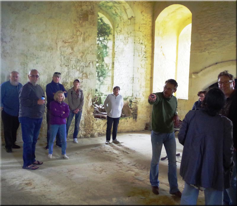
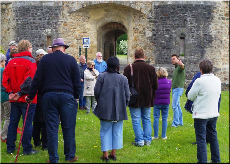
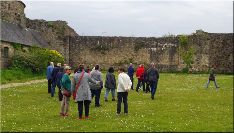
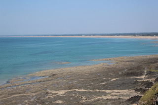
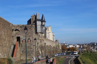
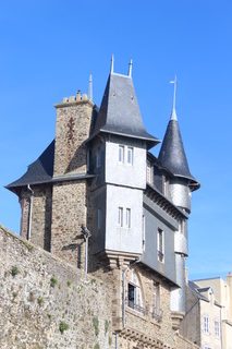
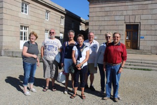
Our second guided walk of 2021 was with Simon Tasset, this time discovering the town of Saint Lô. We met in the large square in front of the Mairie and then, after accessing the north rampart walls, began our tour of the largest walled town in Manche which is built on a promontory dominating this stretch of the Vire valley. We followed the walls to the western end of the old town enjoying high vantage points over the town beneath the walls, the Vire river and views towards Agneaux.
Some 97% of Saint Lô was destroyed by bombing in 1944 and the architectural style of the town now reflects the overriding urgency and construction methods employed to rebuild the town as quickly as possible after the War.
Some 2000 years ago the area around Saint Lo was the home territory of the Unelles tribe prior to the Roman occupation. Moving on a few hundred years after the Romans leave we see Vikings appearing up the Vire river in about 898 AD and laying siege and razing the town. The Vire river became a route to the Channel and to England. Saint Lô was besieged by the English during the Hundred Years War following their landing at Saint-Vaast-la-Hougue in 1346. Saint Lô also suffered during the protestant catholic Religious Wars.
As Saint Lô developed in the Middle Ages the various trades and crafts settled along the banks of the two tributaries of the Vire which flowed to the north and south of the walled town. There was a 16th Century adage that said if you wanted a good knife then you must buy one at Saint Lô. Weaving was also a predominant industry.
Following the French Revolution, Napoleon chose Saint Lô to be the location for the Prefecture of the new Manche Departement. Napoleon also developed Cherbourg as a defended harbour which led to the decline in the trading influence of Saint Lô but later its prosperity and influence subsequently returned as a result of its new civil administration role.
This event rounded off the summer and it was a real pleasure to eat, drink, chat and laugh together, after so many months of Covid restrictions in the lovely garden our two of our members.
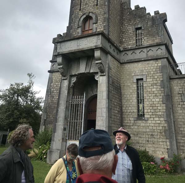
From their home we drove the short distance to the Mausoleum just outside Roncey, where we were met by our guide, the former Mayor of Roncey. We were struck by the sheer size of this monument, with its castle-like design and tall tower. It was amusing to note that the tower remained slightly unfinished, as apparently tax only becomes payable once a building is completed!
After recounting the life story of Auguste Letenneur, who had this monument built for himself and his family, we were taken on a tour of the building. We began in the crypt, which once held the bodies of Auguste Letenneur, his wife and two of their children, until these remains were moved to the graveyard in Roncey in 1972. We then climbed up to what was the dining-room on the first floor and two bedrooms above, used for entertaining and lodging family members from afar on the occasion of religious ceremonies. The views from the very top of the tower were breathtaking.
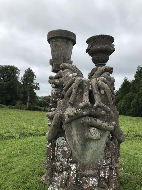
The final surprise was to be found in the grounds: The concrete fountain built by Auguste Letenneur himself and was of a striking design indeed and an unusual monument to the dead.
Once again, our excellent guide and historian, Simon Tasset, brought another piece of Normandy stone to life and, in his inimitable style, allowed us all to imagine the reality of an earlier time.
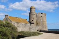
He explained the relevance and importance of the site of this ancient château, originally of timber construction in a motte and bailey format, at this river crossing. The river itself had been diverted from its initial course to enhance the defence of the chateau. A church on the site had been recorded as early as the time of the French Duke of Normandy, Richard the Good (980 – 1026).
We learned of the ambitions and political strategies of one of its earliest documented owners, the colourful and war-hungry baron, Geoffroy d’Harcourt. His ambitions and aspirations had consequences far beyond St Sauveur and even Normandy, influencing English history and creating a link to England that materialised in its reconstruction in stone by English stone masons. In many respects it was considered locally as an English castle and remained a robust architectural statement until seriously damaged by the RAF in 1944.
Geoffroy, you see, was not a peace-loving baron and had military arguments with his close neighbours as well as further abroad (Flanders War). After a “private war” with baron Robert Bertan of Briquebec he was forced into exile, fleeing to England (1343) where he acknowledged the sovereignty of Edward III. He later assisted Edward to land in Normandy prior to the Battle of Crécy. Despite such treachery he was forgiven by the French king, Philippe de Valois, who bestowed upon him the responsibility of defending Lower Normandy. However old habits die hard with the treacherous and Geoffroy next supported a contender to the French throne, Charles of Navarre and he organised military action on behalf of Charles. He was killed in a skirmish, but not until after he had already bequeathed the castle of St Sauveur and it’s sovereignty to the English king in his will.
Geoffroy had spent much time and expense rebuilding the castle in stone and refortifying it to make it ready to receive the King of England. The French king, Philippe de Valois had confiscated the castle (1343) but after Geoffroy’s royal pardon in 1346 Philippe allowed him to continue with the rebuilding programme.
Understandably the two periods of English occupation of the castle at each end of the Hundred Years War (1357 – 1375 by Edward III and 1420 – 1450 by Henry V and Henry VI) were not popular with the French who laid siege twice.
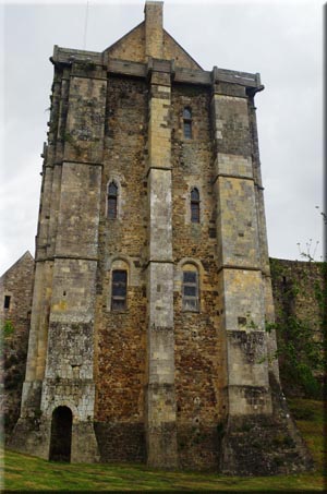
The fortifications undertaken by Geoffroy included the perimeter stone walls with towers which replaced the timber palisades of the interior space of the chateau which was formerly referred to as the barnyard. There was also a dungeon documented and that can be seen to be the ground floor level of the large, remaining keep tower. Note the absence of windows on the ground.
Simon had a particularly large Harry Potter style ancient key in his hand and he used it to open the door of the keep. The dungeon level had no windows and was dark and inhospitable. A narrow, steep spiral staircase in the corner took us up to the first level, a large single room which had a huge fireplace and windows as well as a higher ceiling. The integral mantel of the very wide fireplace is testimony to the work of an English Master Mason since it differs from the more superficially attached French mantels of the time.
The second storey of the keep Simon described as Royal private sleeping quarters, with a somewhat more secretive and intimate nature, accessed by steps down into the room from the spiral staircase, thus allowing some soundproofing from the traffic on the staircase. The quarters also had the luxury of a loo hidden in the opposite corner to the entrance comprising of a hole in the floor. The third storey were guards quarters and we did not visit them due to the unsafeness of the floor. From an arched window on the second floor we could see the Abbey buildings in the distance behind pine trees. On exiting the keep we walked into the courtyard where we noticed the rise in the air temperature outside. One boundary of the courtyard is a fine fifteenth century stone building dating from Henry V’s occupation, with a chapel attached (photos bottom right). This large building gave access to the kitchens (first floor) which in turn had earlier connected to the adjacent Keep tower on the first level via an elevated timber walkway. The adjoining chapel building is now a visitors’ information office.
The interior of the perimeter curtain wall shows evidence of previous adjoining rooflines of ancillary buildings within the courtyard of the castle. There was obviously greater accommodation in an earlier era since Louis XIV turned it into a hospital in 1598 and it was also used as a prison during the French Revolution. Truly a chateau Polyvalente!
Another fine piece of active imaging by Simon …. Thank you.
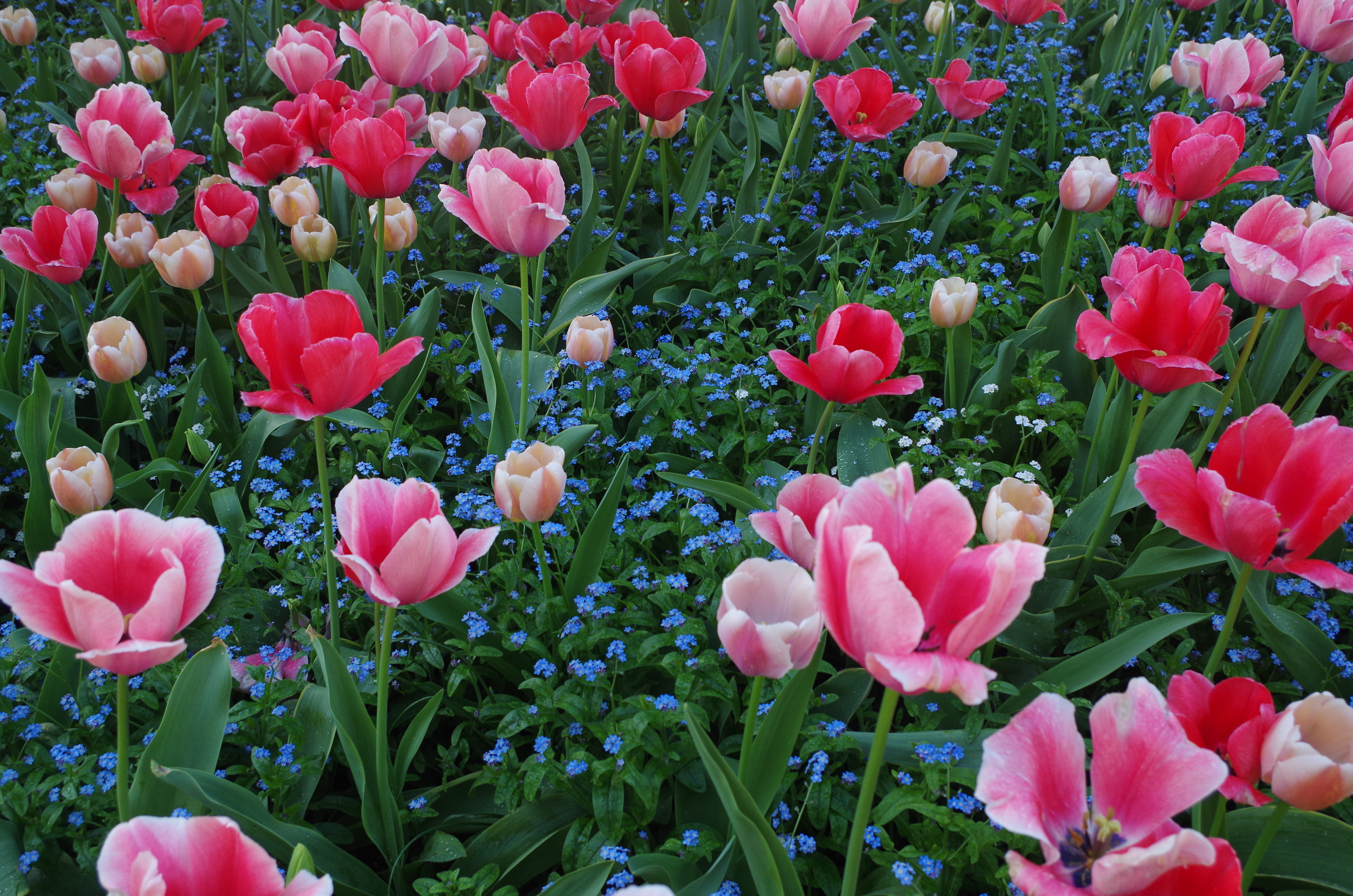
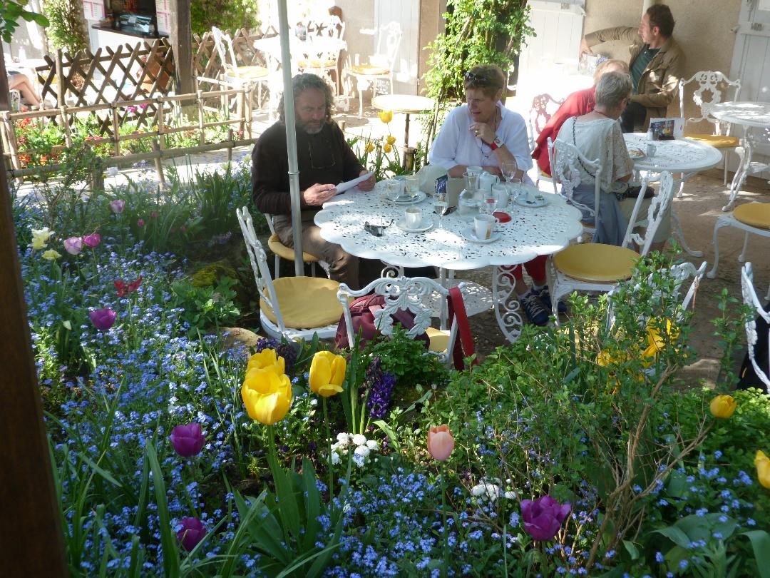
For our trip to Giverny, near Vernon, we were blessed with perhaps the
warmest day of the year. Due to an early start we arrived in Giverny
before it became very busy and we had a wonderful opportunity to see
the garden without crowds of other visitors. After a cold spring the tulips were still glorious and the blossom was breathtakingly beautiful throughout the village.
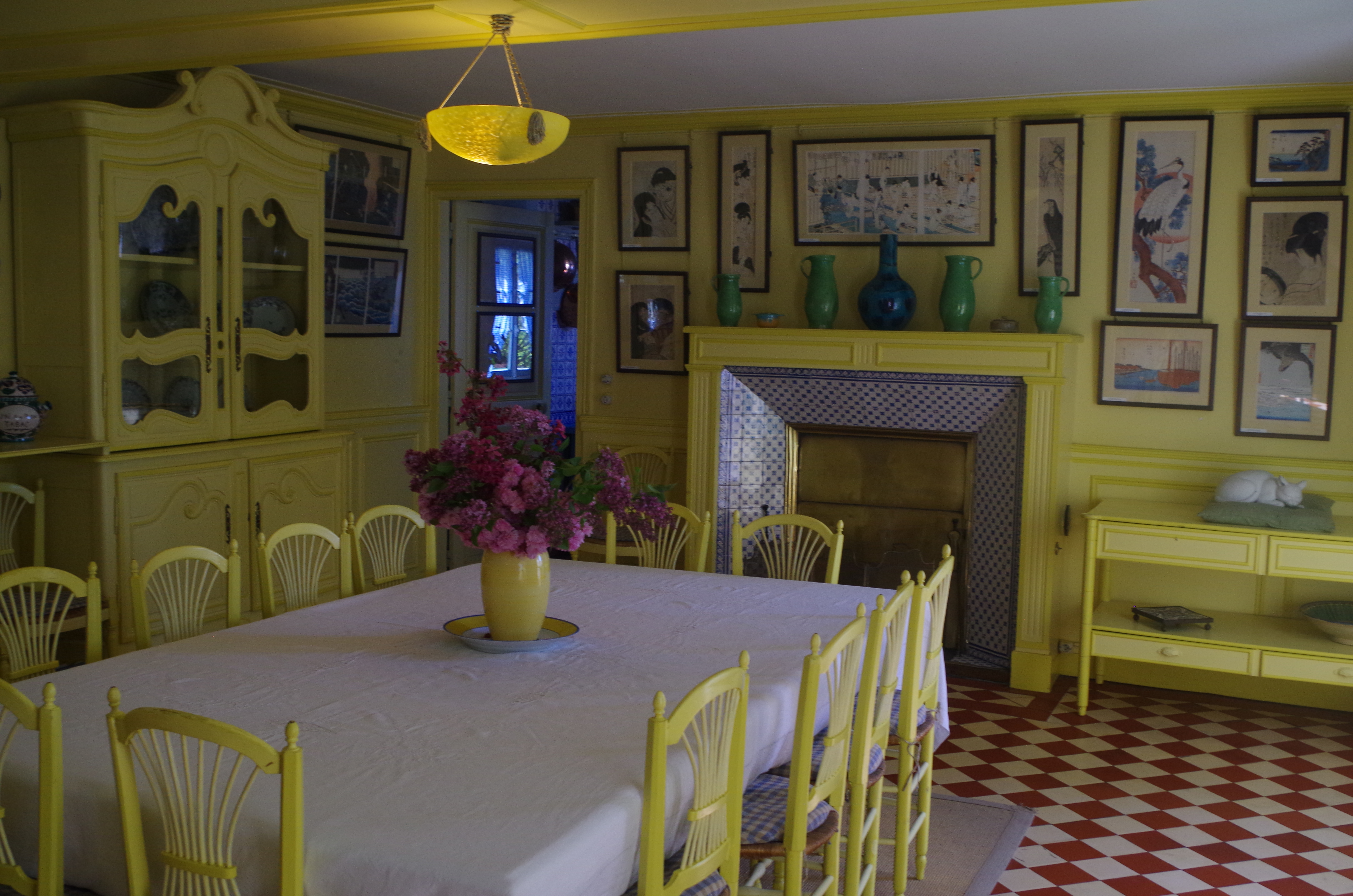
Monet’s house has also been re-created in its original style using many of Monet’s own furniture, fittings and artefacts.
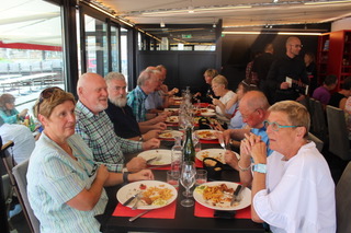
On one of the warmest days so far in June, sun-lovers met at Le Borsalino on the marina in Granville. We enjoyed a varied and unhurried lunch including seafood, salads, turkey, gammon and pizzas.
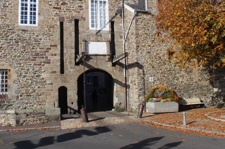
We then made our way to the old portcullis gate at the entrance to the old town of Granville (known as la Haute Ville – high town) to meet our tour guide. It’s a walled fort built on a peninsula. Originally the Portcullis was the only entrance into the fortified town but these days there are three road accesses.
Offering wide open views of the sea on all sides, its strategic importance was noted very early on and the fortified town was built in the 15th century by the English, to control the seas towards le Mont St Michel and surrounding areas. The area near the modern day Casino and beach was carved out so that, at high tide, the sea would come in, meet with the river that flows through the centre of Granville and flow back out to the sea the other side, making the peninsula an island (but only at high tide!). Nowadays, the area has been raised again and no longer floods!
There are two main streets running the length of the peninsula and the cross streets are named after professions (bakers, plasterers, leather workers). People with these professions lived on those streets. If you changed your profession, you had to move out of the street you were living on.
The residents would sell their wares through their front windows. Some of the houses still have these extra wide ledges in place, but the shops and trades have mainly gone now and there are just a few centred around le Place Cambernon, which is the heart of the old town. The residents originally enjoyed a tax free status so it was very popular, with the over spill occupying le rue des Juifs – which still has many small shops and businesses. Much of the old town was built with granite from the Chaussey islands – Coutances and le Mont St Michel also benefited from the granite of Chaussey. The peninsula was occupied (mainly by the allies) during WW2 as it is a very strategic point on the coast offering full control of the sea surrounding it and the bay of le Mont St Michel.
The old town escaped bombings during WW2 and the only damage was sustained by the church when a large and noisy plane flew over and the vibrations caused all the windows in the church to blow out. These were replaced in the 1950’s. When the Eglise Notre Dame du Cap Lihou was originally constructed the design was Roman, but it was not completed at that time. It was later completed in a gothic style and the two very distinct halves are easily seen from the inside.
Near the church is a very unusual house built into and on top of the fortified wall – it is almost like a small fairytale castle.
Much to our surprise, our tour guide informed us that it was actually only built at the turn of the last century. It is privately owned but rumour has it the owner does, very occasionally, open it up to visitors. Our tour guide was delightfully well-informed and able to answer all our questions. Our thanks to Chris and the committee for organising such an interesting day.
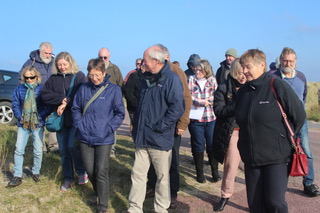
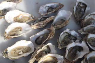
October 13 was a lovely sunny day as 19 of us gathered at the marine supplies shop in Blainville-sur-Mer to spend a morning learning about the production of oysters.
Our guide was Claude, who was a mine of knowledge, not just on what happens to today, but also on the history.
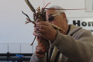
He explained how oysters were first transported from Normandy to Rome, with an ingenious network of staging points where the oysters could be kept alive in pools. He brought us up to date, via the Greeks and Louis XV, to the present day and the intensive and innovative production methods. By this time the sunny day had become accompanied by a keen breeze, and we were all a little relieved to hear that we were going indoors.
We headed into the workshops, where we saw how the oysters are stored, cleaned and sorted. This was followed by perhaps the highlight of the visit – a chance for a dégustation! The oysters just kept on coming – and as they were absolutely fresh they were also absolutely delicious – and the accompanying Muscadet made things just perfect. A lovely visit – many thanks to Chris for the organisation and to her and Caroline for the excellent job they did of interpreting Claude’s presentation.
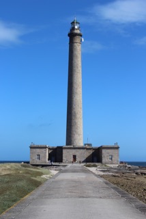
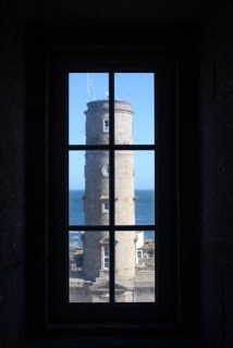
Friday 9th September dawned cloudy and breezy with a threat of isolated showers. We had a long drive ahead of us to get to the top right hand corner of the Cotentin peninsular by 10.45, to visit the lighthouse at Gatteville. There seven of us set off up the 365 steps to get to the top; at 75m it is the second highest phare in the whole of France.
The vertical challenge was met, with a few stops on the way up, and the views in the now sunny, but still breezy, weather were amazing. Thankfully none of us needed the defibrillator that was prominently displayed on the top floor!
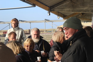
After the long descent, which all agreed was less strenuous but more uncomfortable, we set off in convoy along the delightful coastal road to find St Vaast-le-Hogue and the Le Débarcadére restaurant for lunch. There we were joined by those who had declined the vertiginous lighthouse option. The repast was first class with sixteen of us sharing a convivial couple of hours.
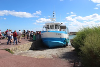
After lunch Kenza got into commanding mode and we set off to get our tickets for the crossing to the Isle of Tatihou, barely a kilometre offshore. The embarkment point was a good ten minutes walk away on the far side of the harbour and some wise souls (or should that be soles?) drove around to save their legs and feet for the perambulations once ashore. The little blue vessel that takes folk back and forth had the look of a large version of a toy boat; more so in that it had wheels! When it arrived to collect the fourteen of us it ‘drove’ up a slope out of the water so that we could step aboard; the same procedure applied at the other end. We visited during high tide, but at low tides it ‘drives’ the whole way!
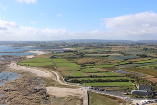
The island of Tatihou has fascinating history – very well explained and illustrated in the museum. But that’s not all there is – there are a variety of gardens, various old stone houses and military barracks as well as the prominent and famous Vaubon Tower, erected as part of the defences put on Tatihou at the beginning of the Thirty Years War.
The weather stayed magnificent all day, even getting hot. By the time we all re-boarded the little blue boat, we knew we had walked a lot. And we all agreed that we had had a really lovely day out.
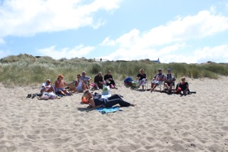
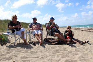
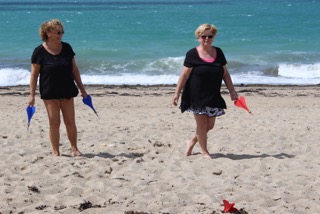
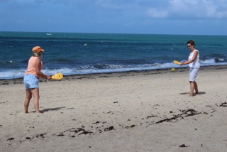
A picnic, a swim in the sea and a game of bat and ball – some of the simple pleasures of the annual beach picnic, one of my favourite Anglophone events, held this year on 11th August. It was a cool blustery day, but at least the sun was shining.
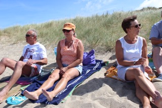
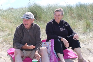
We gathered on the beach at Gouville at midday, 14 adults and 3 children, to enjoy our picnics, sharing around some of our goodies
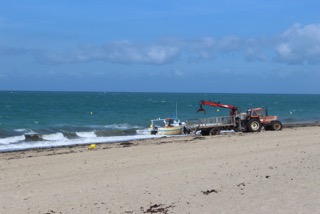
Next, a swim and games. With a brisk wind, the sea was very rough, an orange flag was flying, and we had already watched anxiously as some fishermen struggled to bring their boat ashore in the big waves.
Nevertheless, three brave souls ventured in for a paddle and a bracing swim.
Some of us played bat and ball, both singles and doubles, others played beach darts, the children larked around in the sand, and the rest sunbathed, chatted and relaxed, all happy to spend some time together at the seaside.
It was a very enjoyable afternoon and reminded us how lucky we are to live near these fabulous Normandy beaches.
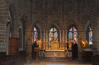
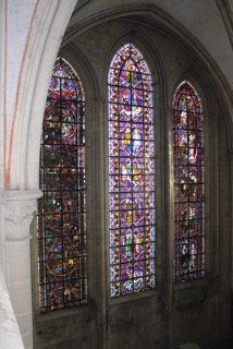
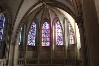
“Wear warm clothes” came the surprising advice from the organisers. Well, it is still February so why would we need the reminder? 27 of us met at the appointed hour and were split into 2 groups, because some parts of the tower structures cannot support more than 14 people. Our group started at the bottom, and sat in the body of the cathedral for an interesting historical summary of over 1000 years of Christianity in the Coutances area.
A cathedral is a symbol of the power and authority of the church throughout history and the talk reflected as much of political history as religious. Our guide was clearly well versed in architecture and history and her spoken English was excellent. The warm clothes were proving to be welcome as we walked around the “Ambulatory”. A new word for our vocabulary: it is the space where clergy (and tourists) walk around behind the altar. Our guide showed us the painted walls, (11th century as I recall) and explained the light airiness as being the result of light coloured windows interspersing the darker coloured windows and the lack of dividing walls between the small chapels.
Then it was through a big wooden door and up the first of the spiral stone staircases. Whilst not for the faint hearted, these climbs were not as bad as some of us expected; coming out into small rooms and long stone corridors. We felt very privileged to walk on the uneven pavement overlooking the nave area from small apertures in the wall. Upwards again to the third tier. Across a wooden walkway and up more stone steps. Arriving, eventually on a narrow ledge high in the tower. Our guide explained how a square base becomes an octagon and then becomes a circle; giving the space, light and strength that typifies Coutances cathedral.
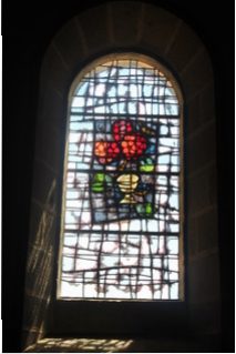
We exclaimed over the ancient graffiti (yes really!) and clutched our spectacles as we gazed down at the splendour below. One window described the link between Thomas Becket (late archbishop of Canterbury) and Normandy. We all revelled in our Norman ancestry as the historic links between our two countries was revealed. Downwards by a different route which meant that the most spectacular view was the climax of the visit. On the walkway above the Ambulatory we could look straight down the nave. It reminded of those high camera views of Royal events at Westminster Abbey.
Afterwards (and by this time well and truly cold, despite the warm clothes) we adjourned to “La Moriniere” for a very Norman lunch of Gallettes and Crepes. It was a very convivial end to an informative morning.